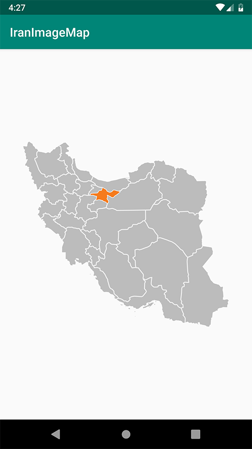
Iran Image Map

Iran Image Map is ImageView with customizable provinces on map.

Iran-Image-Map

Usage

    <com.salehi.iranimagemap.lib.IranImageMap
            android:id="@+id/map"
            android:layout_width="match_parent"
            android:layout_height="wrap_content"/>

Code

        IranImageMap imageMap = findViewById(R.id.map);
        imageMap.clearAllProvince();
        imageMap.setActiveProvince(ProvinceList.Tehran);

Download

include in app level build.gradle

       repositories {
          maven { url 'https://jitpack.io' }
       }
        implementation 'com.github.mehdi-salehi:IranImageMap:1.0'

GitHub